Subak Bali is the cooperative system of canals, weirs, and water temples that farmers use to share irrigation water across the island’s rice terraces. UNESCO describes it as a water management system that dates back to the 9th century, and in 2012 it became part of the Cultural Landscape of Bali Province, a World Heritage property. Behind the green terraces in a Bali landscape painting is this system.
Key Takeaways
- A subak is both a farmers’ association and the irrigation network it manages, and each one is run by its own members.
- Water is shared by agreed schedules, not by who owns the highest field.
- UNESCO inscribed the Cultural Landscape of Bali Province in 2012, with five component parts that include two water temples and a crater lake.
- Jatiluwih sits inside one of those parts, Catur Angga Batukaru. It is not a separate listing.
- When a painter shows terraces, canals, farmers, and offerings together, the picture is showing the subak at work.
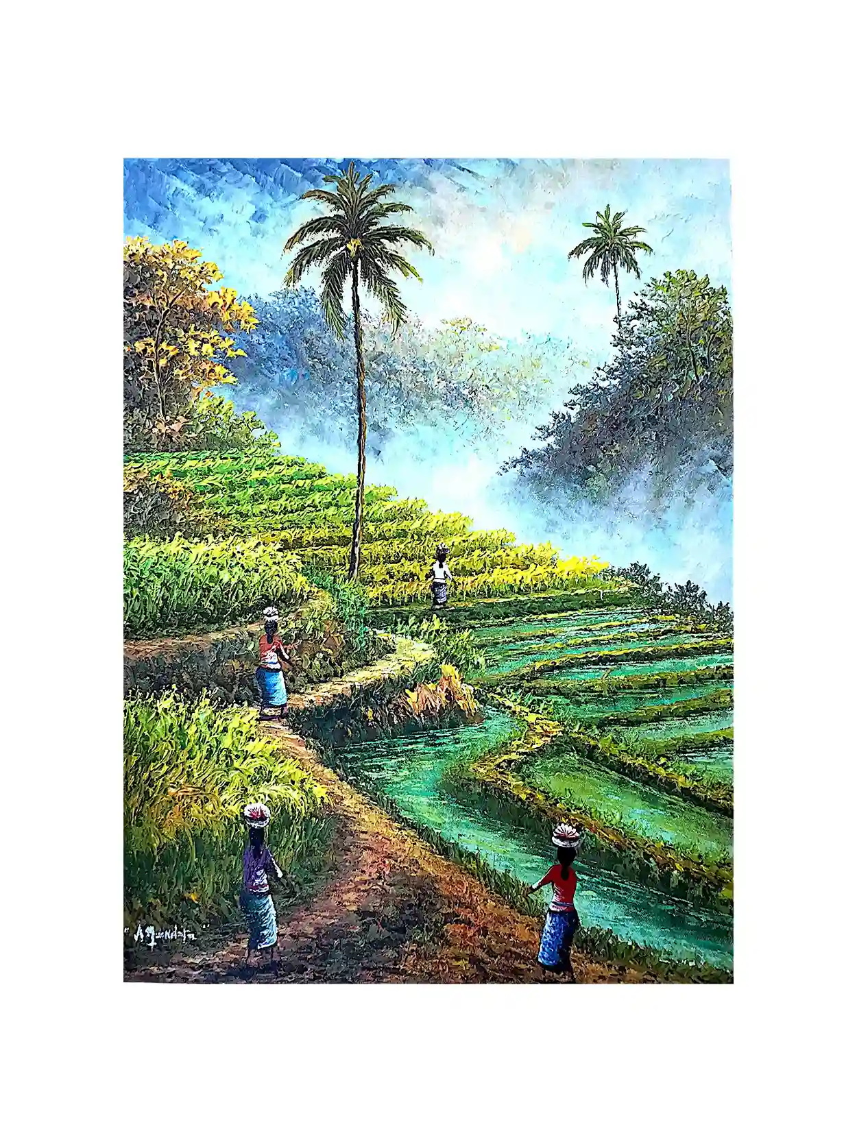
What Subak Bali Is and How the Water Gets Shared
Walk past one of the Bali rice terraces and it looks like plain farmland. Look a little longer and you notice the thin channels cutting along the edges, the small gates that control the flow, and sometimes a little shrine at the corner of a field. That is the subak. The word names the group of farmers who share one water source, and it names the whole irrigation network they look after together.
Wikipedia’s entry on the subak irrigation system puts it as a water management system for rice paddies made up of terraced fields, water temples, canals, tunnels, and weirs. The same entry says the system emerged around the 9th century, with written records from about the 11th. UNESCO’s own wording is close: a cooperative network of canals and weirs dating back to the 9th century. So when someone tells you the subak is “ancient”, that is a fair word, and it comes from both sources.
The practical point is simple. Bali’s rice terraces step down steep volcanic slopes, and the water has to pass through many fields in order. If the farmer at the top takes too much, the farmer at the bottom has nothing. The subak is the agreement that stops that from happening.
How It Is RunWho Decides: The Pekaseh, the Awig-Awig, and the Meeting
Each subak has a chairman called a pekaseh. The members meet in a gathering known as the paruman krama subak, where they decide when water is released and when planting and other farm tasks begin. The rules they work by are called awig-awig. These are the regulations the subak’s management sets for how the group works.
Larger subak, called subak gede, coordinate several smaller ones. Wikipedia describes a system in which members are grouped into upstream, middle, and downstream sections that receive water in turn. It is a rotation, and it only works because everyone accepts the schedule.
That is the part a painting cannot show you directly, but it explains why the terraces look so tidy. Fields are planted and watered on a shared rhythm, so where the schedule holds, neighbouring terraces move through their stages together. If you have ever wondered why a Bali rice view looks so orderly from a distance, shared timing is part of the answer.
“Brings together the realms of the spirit, the human world and nature.”
UNESCO World Heritage Centre, describing Tri Hita Karana and the subakWater Temples and Tri Hita Karana
The subak is not only engineering. UNESCO says the system reflects the concept of Tri Hita Karana, which links the spiritual realm, the human world, and nature. In practice that shows up as temples. UNESCO states that water temples are the focus of cooperative management for groups of subak, so the groups that share water are tied to the same temples.
At the top of that network is Pura Ulun Danu Batur on Lake Batur, listed by UNESCO as the supreme water temple. It is one of the five component parts of the World Heritage property. Wikipedia adds that other water temples connect upward to it, which links the practical sharing of water to a single spiritual centre.
If you want a different water temple to picture, our guide to Pura Ulun Danu Beratan covers the lakeside temple on the 50,000 rupiah note. It is a well-known water temple, though it is not one of the UNESCO component parts listed below, so treat it as a companion read and not part of the inscription.
The rice goddess belongs here too. Farmers honor the rice goddess with offerings, and we wrote about that side of the story in Dewi Sri, Bali’s rice goddess, and it pairs naturally with this article.
World HeritageThe Five UNESCO Components of the Subak Landscape
UNESCO inscribed the Cultural Landscape of Bali Province: the Subak System as a Manifestation of the Tri Hita Karana Philosophy in 2012, under criteria (iii), (v), and (vi). The property is not one big field. It is five component parts that together represent the system.
| # | Component (UNESCO listing) | What it is |
|---|---|---|
| 1 | Supreme Water Temple of Pura Ulun Danu Batur | The supreme water temple, on the edge of Lake Batur |
| 2 | Lake Batur | The crater lake regarded as the origin of every spring and river |
| 3 | Subak Landscape of the Pakerisan Watershed (UNESCO also spells it Pekerisan) | Described by UNESCO as the oldest known irrigation system in Bali |
| 4 | Subak Landscape of Catur Angga Batukaru | Terraces mentioned in a 10th century inscription, and the area that includes Jatiluwih |
| 5 | Royal Water Temple of Pura Taman Ayun | Described by UNESCO as the largest and most architecturally distinguished regional water temple |
Source: UNESCO World Heritage Centre, listing 1194, component parts. The third column is our short summary of UNESCO’s descriptions.
One thing people often get wrong: Jatiluwih is a place inside the Catur Angga Batukaru area, not a separate World Heritage site. Published summaries of the property place it there. Other famous terrace viewpoints you may have seen on social media are a different matter. We have not found a clear, consistent source on whether a given viewpoint falls inside the inscribed boundaries, so we are not going to guess. If a specific terrace matters to you, check UNESCO’s map for the property before you plan around it.
The ResearchWhat Happened When Farmers Stopped Following the Schedule
A widely cited study of the subak is by the anthropologist J. Stephen Lansing. Wikipedia notes that in the 1980s he and James Kremer showed that Bali’s water temple networks can self-organize to manage rice terraces at the scale of a whole watershed. In plain terms, the shared schedule is not decoration around the farming. It is how the farming works.
The Green Revolution gives the clearest example. In a talk for the Long Now Foundation, Lansing describes the program reaching Bali in 1971 and pushing farmers to plant as often as possible, which cut against the temple-managed schedule. He says harvests were lost to pests year after year. Wikipedia’s entry on the subak puts the pest losses at up to 50 percent in the late 1970s, when subaks planted rice continuously. Lansing says that in the 1980s the Balinese government dropped the “plant often” and pesticide parts of the program and renewed respect for the water temple system.
Treat the numbers as reported figures, not our own measurement, and read Lansing’s book if you want the full argument. The takeaway for our purposes is simple: planting together keeps pests in check, and that is a job the shared schedule does.
Terrace steps
Each level is a plot that receives water in turn. The water moves down through them in order.
Channels and rivers
The thin waterway is the subak’s backbone. When a painter draws a canal or river through the fields, that is the shared supply.
Offering processions
Women carrying offerings along the paddy path are making the ritual side of the system visible.
Farmers at work
Small figures bending in the fields are the members of the subak. Their shared schedule is part of why neighbouring fields move together.
Seeing a Subak in a Painting
The gallery recently listed a group of rice terrace paintings, and they are why we wrote this piece. We want to be straight about what that connection is. The artworks are impressionist palette knife landscapes. The listings do not name a particular village or subak, and we are not claiming they show one. What they do show are the parts of the system a painter can see: terraces, a river or canal, farmers, a mountain, and in one case a procession of women carrying offerings.
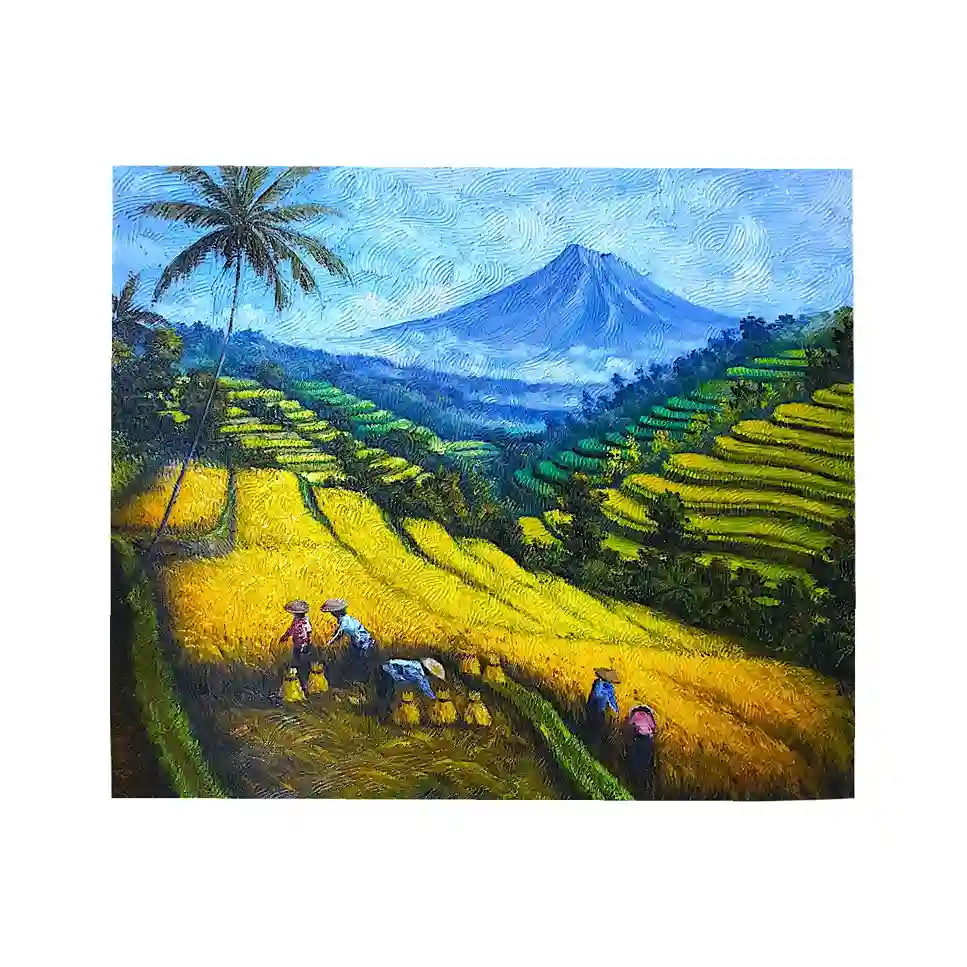
The mountain in this one matters more than it first appears. In Bali’s geography, water comes down from the volcanic highlands, and the subak system is built around that flow. A painter who puts a peak above the terraces is, whether they intend it or not, placing the fields where the water begins.
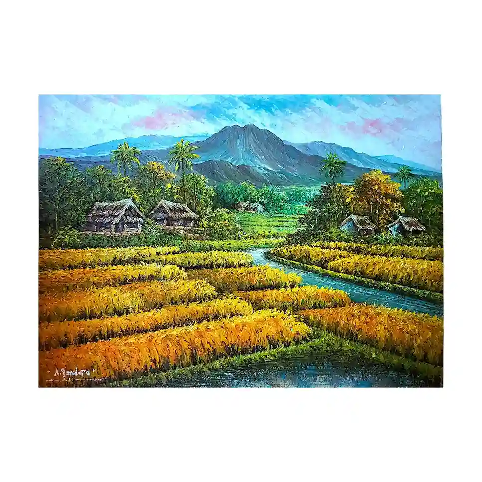
Here the river is the subject. It is the clearest picture of the shared supply in the set. If you like the idea of a painting that quietly tells the story of water, this is the one that does it most directly.
If you are weighing rice field art for a room, our earlier guides cover the buying side: why the sawah never leaves the canvas, ,"...... golden harvest paintings, and how palette knife painting builds this texture. For the ceremonial side, see Balinese village life painting.
Why It Matters NowThe Pressures on the Terraces
The Wikipedia summary lists several threats to the system: conversion of rice land to commercial development, tourism’s demand for water, saltwater intrusion as water tables fall, and the difficulty of making a living from small plots as farmers age. We are not going to quote percentages here, because the figures vary by source and year. The direction is what matters. The terraces you see in a painting are a working landscape under real pressure.
That is one reason we like paintings of working terraces. They keep the water, the farmers, and the light in one picture.
Ask About a Rice Terrace Painting
Tell us the wall, the light, and the mood you want, and we will suggest pieces from the gallery. We ship worldwide.
在 WhatsApp 上聊天View Morning Awakening